by Howard Rowson >>
12-6-2013 06:53:42
 | |
So! Summer to Autumn in a week , hmm got to love the UK climate .. Well after a quiet sunny week with a high pressure domiated synopsis, low pressure soon back on the scene once the hp eased off to the north east. We currently have low pressure systems piling in from the west swinging up through the UK with associated wind in tow. One such system will be tracking NE across the UK tomorrow, delivering decent flow from the SW for the south coast around to the Ray, coinciding with the low tide there @ 0950hrs. Generally windy and unsettled thereafter, so plenty to go at over the next wekk or so.
|  |
by Mark Hayford >>
12-6-2013 10:41:10
 | |
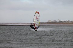
A couple off us are hopping to get out on xl speed kit tomorrow at WK. With a bit of luck, the sun might make a short appereance as well, would be lovely to have a NON-winter wetsuit session this summer:))
|  |
by Bryn Dampney >>
12-6-2013 11:35:06
 | |
| Can see st.johns from my new job, nothing but rain at the minute! |  |
by Howard Rowson >>
12-6-2013 20:22:01
 | |
Southend still looking pretty good for tomorrows' mid morning low tide, best of the wind coinciding with the window of opportunity - at a push F6-F8 Sw'ly may well be realised. MetO have Severe wind warnings in force for much of the M4 corridor out to the Thames estuary and north to the Wash. Bear in mind summer severe wind warnings are not marked at the same scale as Autumn / Winter severe wind warnings hence the 40-50mph peaks and not the 60+ we would expect with such a warning.
|  |
by Howard Rowson >>
13-6-2013 19:45:44
 | |
Saturday looking like a repeat performance of today ... one additional aspect to watch is the development of the storm tracking east across ireland, nae model has it whistling east across the northern irish sea with a swathe of WSW to West gales on its southern flank which potentially puts WK in the line of fire.
|  |
by Howard Rowson >>
13-6-2013 19:47:15
 | |

|  |
by Howard Rowson >>
13-6-2013 19:47:56
 | |

|  |
by Howard Rowson >>
13-6-2013 19:50:18
 | |
A small window of opportunity for WK to fire Saturday afternoon, small , nonetheless an opportunity.
|  |
by Ian Richards >>
14-6-2013 16:15:55
 | |
Southend on Saturday maybe??
|  |
by Howard Rowson >>
14-6-2013 17:01:32
 | |
As the window for WK has been firmly shut with the secondary low not developing, the South Coast again looking pretty good, the Ray looks like peaking mid to late arvo so after the low tide window, nonetheless breezy for the low tide though, south coast looking good most of the day from the South West / WSW
|  |
by Howard Rowson >>
17-6-2013 18:41:15
 | |
The south coast looks like firing up again as we hit the weekend, with low pressure sinking se across the uk from the nw. Saturday looking the best of the wind at the moment from cornwall to the iow from the wsw/sw, southend may get a look in too, with wk basking in light wind and murk, nothing new under the sun then.
|  |
by Howard Rowson >>
18-6-2013 06:51:39
 | |
GFS offering up some 00z run eye candy this morning, its on its own at the moment with the MetO and ECMWF not dialing in such a deep storm for Saturday. ECMWF the worst of the 3 , MetO taking the middle ground. One to watch for favourable developments
|  |
by Howard Rowson >>
18-6-2013 12:39:43
 | |
3 Stormtracks to follow now, GFS, ECMWF and MetO all have different outcomes for the weekends' wind, lets have a closer look at each.
- GFS. (006z run) Currently showing a deep area low pressure to the SW of Iceland, we’ll call this the primary lp as it is the key driver to what happens upstream to the west. By Friday the Primary LP has filled and drifted NE to the ne of Iceland with a secondary lp swinging in towards the UK on the primary’s sw flank. The jet stream model shows a powerful (for summer) surge west – east across the north atlantic towards and on over the uk. The jet forecast is key to powering up and guiding the secondary lp. At present the jet deepens the secondary just to the west of Ireland circa 990mb, early Saturday morning. Thereafter the jet weakens a notch and the secondary fills slightly as it crosses Scotland / northern England circa 995mb, with the strongest of the flow reserved for the south coast through Saturday arvo from the sw. Thereafter the secondary drifts east into the north sea and fills, setting up a cool moderate west to nw flow over the uk.
- ECMWF (00z run). Initially similar to the GFS model to Thursday , thereafter the primary drifts ne leaving two possible lp centres in its wake. By Saturday once centre located just west of Norway, the other (gfs secondary) swinging in from the west towards Ireland, early Saturday, filling to 1000mb over central southern England Sunday with the best flow reserved for the bay of Biscay, with the Uk then under a nw-n flow.
- MetO (00z run). Initially as per ECMWF and GFS, thereafter the MetO model portrays a halfway house between GFS and MetO, but in this case it’s the primary that stalls over Iceland then sinks south deepening as it drifts down the from the north over the western fringes of the UK, again the best of the flow over nw france / Biscay, early Saturday, As the system fills over northwest Europe early next week , perhaps a strong westerly flow setting up for a while over the south coast and west across wales.
In summary: Plenty to keep an eye on, especially with the anomalies between the 3 models.
|  |
by Matthew York >>
18-6-2013 16:38:41
 | |
tides arent great for southend sat , either 6am low tide or 6.45pm :( lets hope it goes west ::)
|  |
by Howard Rowson >>
18-6-2013 17:55:09
 | |
Interesting outputs from the MetO 12z with a significant northern shift of the incoming LP on Saturday. Isos tight for a good southcoaster Saturday from the sw/wsw with the LP tracking east further north Sunday with an improved chance of seeing a veer to west or wnw Sunday arvo. MetO and GFS 12z outputs not too disimilar, we wait on the ecmwf 12z for hopefully some verification of the Met and GFS models.
|  |
by Howard Rowson >>
18-6-2013 17:59:21
 | |
Great time of the year for wind Matt especially if the Sun shows - dawn to dusk speedsailing at WK was on the menu back in the late 80's 3-4hours of speedsailing before the mandatory bacon and egg breakie!
|  |
by Howard Rowson >>
18-6-2013 18:20:31
 | |
Not forgetting our fellow speedsailors over in Eire with Dungarvan in the line of fire for Saturday too with a wsw'er and a low tide mid arvo ....?
|  |
by Howard Rowson >>
18-6-2013 18:41:47
 | |
Ecmwf 12z verifying the GFS and MetO outputs with the northern shift of the lp saturday into sunday - still early days at present but a significant improvement over the 00z runs this morning.
|  |
by Howard Rowson >>
18-6-2013 18:45:10
 | |
MetOffice Outlook for Thursday to Saturday:
Increasingly unsettled with showers, some heavy on Thursday, and the risk of longer spells of rain at times. Cooler into the weekend with strong winds, and the risk of gales.
Issued at: 1600 on Tue 18 Jun 2013
|  |
by Howard Rowson >>
19-6-2013 07:00:36
 | |
Ok the good and the bad ...... The good - all 3 models are in agreement with the approaching system Saturday .... the bad the system needs to deepen further on approach and not fill during transit of the UK Sunday otherwise the isobars will not be tight enough to deliver a strong to gale w-wnw Sunday. Its all down to the fine detail now as to how the system develops over the coming days. By no menas set in stone yet, so plenty of time for inbound adjustments which can have a significant effect on the eventual outcome.
|  |
by Howard Rowson >>
19-6-2013 17:14:00
 | |
Stats for Sunday based on the 12z outputs from just the MetO for the moment are that we have a slight increase in the likelyhood of a West veering WNW flow for WK on Sunday, still early days yet, but current forecast stormtrack is good, a little further intensification of the system and we may see F6-F8 from the west (early) to wnw. At present 20-30kts looks feasible. A slight fly in the ointment (apart from the drizzly murk) is the 9m high tide around 11:30 which will breach the wall based on a wnw push in off the Irish, worse case scenario 1100-1200hrs, 1hr of downtime. or tidetime if thats your cuppa.
|  |
by Howard Rowson >>
19-6-2013 17:17:12
 | |
Best of the wind though will be the afternoon (post high tide) peaking late arvo early evening before the veer to NW late evening.
|  |
by Howard Rowson >>
19-6-2013 17:22:28
 | |
Now where did I put those GT31 gizmos, no doubt they'll need a charge up 
|  |
by Howard Rowson >>
19-6-2013 17:26:21
 | |
Watch out for some heavy duty supercells tomorrow, very humid air being imported from France coupled with a cold front moving in from the west ... Boom!
|  |
by Howard Rowson >>
20-6-2013 06:38:48
 | |
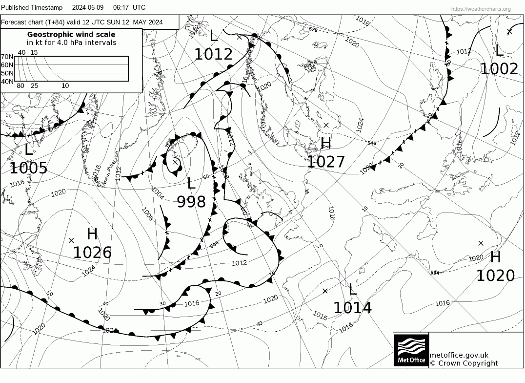
Ok we have an upgrade from the MetO this Thursdays early 00z run. Stormtack is still just about spot on to deliver a west to wnw flow. Pressure differential has increased with the isos somewhat tighter now delivering F6-F8 for Sunday, The only downside at present is going to be the location of the occluded front which is currently shown to be bang over WK early Sunday drifting south as Sunday progresses. Prior to Sunday, Saturday/s wind will be on the up from the outset as the storm approaches Scotland from the west, with the southcoast and up the irish sea winds hitting galeforce from the wsw/sw through the afternoon, berfore the veer to west early sunday morning. Plenty to keep an eye on as the situation develops.
|  |
by Howard Rowson >>
20-6-2013 06:45:03
 | |
|  |
by Howard Rowson >>
21-6-2013 12:37:09
 | |
Difficult to judge Sunday's forecast at present, th eoccluded front Sw of Wk early Sunday starts to track back ne towards WK by noon as the storm pulls away to the ne during the day, dragging the occlusion with it. The angle forecast is wnw, but tthat may well end up being closer to NWbW and too broad by noon... one to keep a close eye on has the situation develops.
|  |
by Howard Rowson >>
21-6-2013 17:25:12
 | |
This one is a trickly fellow! The occluded front is a pain in the backside kind'a messing up the flow depending on whether you are north or south of the front, It's difficult to say if the gfs model is taking it into consideration with its west 2 wnw flow for most of Sunday. MetO holding a west veering wnw 6-8, nae model indicating the flow going nw by noon, ships inshore sw veering nw.. so all in all a tad in the air at present. 11th hour call .. again .. nowt ever clear cut for the kirb.. .We'll see how Sunday shaping up tomorrow.
|  |
by Howard Rowson >>
22-6-2013 10:00:30
 | |
A hard call this one, too much variation in the flow to be a clear cut call. GFS model 06z run still calling a west to wnw flow for most of sunday 5-7 poss 6-8, MetO calling a West veering WNW through the morning 6-8 maintaining a wnw flow until early evening poss peaking 7-8 gusts to F8+ mid to late arvo. Now the Nae model, normally this model calls the shots for WK. WInd initially West at day break 5-7 veering wbn to wnw mid morning, veering further to the wnw by noon, 6-8, by 1500 (not sure if the times are BST or GMT) NWbW F6-F8 gusts to F9 (NWbW is approaching 155 degrees so way past the 143 degreee WNW angle), the wind then continuing to veer to NW by then hooning in F7-F8 gusts to F9. So based on the available evidence from the 3 main models, you can see that with the high degree of variation in angle for the afternoon a hard call indeed. The morning sailable - more than likely , after the high tide breach 11'ish through to noon though it could go too broad or stay sailable - the occluded front angle and the isobar angle would lead be to judge it willl go too broad quite soon after noon. Nonetheless the occlusion and the orienation of the storm and thus the angle of the isos are subject to change until Tzero (time zero). The occlusion's postion has shifted further north over trhe past 24hrs for noon Sunday, the veer to too broad appears to be on the western side of the occlusionm so once that hits and clears the flow will go NW. I'm on the updates through the day and will post once available
|  |
by Howard Rowson >>
22-6-2013 23:20:04
 | |
11th hour 59th minute on thus one ...... All forecasts bar nae going for a west veering wnw 6 to gale 8 for the best part of the day ... the nae running with a west veering wnw for the morning, with the afternoon starting wnw broadening a notch early afternoon... now will the extra angle over wnw be to broad ? thats the big Q gut feeling is it will go too broad post high tide retreat ... hope it does n't, but the nae cannot be ignored at this late hour ....the strongest of the flow looks to be pm .. so we'll see how thungs are shaping up in a few hours..
|  |
by Howard Rowson >>
23-6-2013 08:57:12
 | |
Current stats for WK: Wind currently bang on WNW, it has recently veered from WbN, and uncreased from 25-35kts to 30-40kts or thereabouts. Hopefully WNW should be maintained until the HT breach 11'ish. Post high tide retreat WNW should still be the flow angle. The occluded front currently forecast to move from wesrt of WK to east of WK around early to mid arvo, this transition may see the wind veer to a broader angle than WNW, the strnegth of which should be around 30-40kts .between 1600 and 1900hrs the flow by rights shoiuld go too broad based on MetO data, Nae has the flow superbroad by 1500 and too broad @ 1800hrs. The inclusion is forcast to hit anglesey around 1300hrs , up strean of WK, at a guess 1500hrs WK
|  |
by Howard Rowson >>
23-6-2013 15:00:14
 | |
The flow currently too broad , however the occluded front as re orientated with a more west - east bias, currently just south of wk and heading north ... the flow on the south side of the occlusion is back on a west to wnw angle .. could be back on once the occlusion shifts north of WK .....
|  |
by Howard Rowson >>
24-6-2013 07:09:38
 | |
Thta was one bad ass occlusion, it got well and truly hung up over north wales not clearing east and north of WK until mid evening, keeping the flow on the northern side of wnw, by the time it did clear, the flow was always going to be from the north west .. nonetheless well done to Jon and Ian for making the most of a difficult one to forecast, and some great speeds acheived during the sailable time... nice 40avg Jon, a great milestone ticked off mate .. well done! The flow for the foreseable remains predominantley from the West with the chance of some embedded storms in the flow leading to a sw veering west type setup. The synopsis is more a kin to october type weather but with the jetstream powered down for the summer, we either have to wait for a deep ex trop storm to wing its way over or hold out for one of the weaker embedded storms to hit the target.....we shall see.
|  |