by Howard Rowson >>
8-8-2013 06:39:38
>>
8-8-2013 06:39:38 | |
Tropical Atlantic very quiet so far this year, a little odd considering NOAA's forecast for an above average Hurricane / TS season. So far this year the weather is going by the seasons, therefore can we expect a windy autumn? .. may be. In the meantime we have a fairly weak zonal flow with HP to our SW and LPs tracking east to our north. There is a chance that at some point in time the isos will tighten up to squeeze some wind out of the setup. One possible scenario for this to happen could be Sunday into Monday, with a freshening westerly breeze, perhaps veering wnw monday. nothing epic 20-25kts potential for Sunday afternoon into Monday. Keeping an eye on it, and possible further development.
|  |
|
by Ian Richards
>>
12-8-2013 16:51:43 | |
At last the UK might get some wind this weekend, Southend, West Kirby and south coast spots all looking good.
|  |
|
by Matthew York
>>
13-8-2013 07:55:19 | |
fingers crossed it stays , im up for any of them ian :)
|  |
|
by Howard Rowson
>>
13-8-2013 17:47:33 | |
Almost a repeat performance of last weekend chaps, this time low pressure a little deeper and closer to Scotland, as Saturday unfurls into Sunday, with a SW (Sat) veering West to WNW (Sun) flow. A little early to track until later in the week. Thereafter a return to settled summer weather for a while before Autumn unleashes all Hell and Fury! 
| |
|
by Howard Rowson
>>
13-8-2013 17:49:15 | |
btw. found that problem with not working when compiling a post ... IE10 .. works fine on
Google
Chrome
Ok

| |
|
by Howard Rowson
>>
13-8-2013 17:51:49 | |
lol < CR > with no spaces doesn't get displayed . The above should read "found that problem with carriage return not working" ...
| |
|
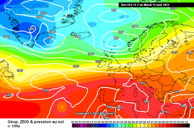
by Howard Rowson
>>
13-8-2013 18:48:55 | |
Here's a quick round up of the 3 main models @ 12z for Sunday noon
ECMWF - WK on the borderline for F5-F7 from the West

MetO - WK on the borderline for F5-F7 from the West

GFS - WK WSW F3-F4
| |
|
by Howard Rowson
>>
14-8-2013 18:58:54 | |
Ok todays' 12z runs indicating a downgrade from yesterdays' 12z runs for Sunday. Pressure differntial not as great, therefore the wind strength backed off a notch MetO wind stats for WK Sunday peaked last night at 6-8 from the west, slowly easeing through todays' updates to 5-7, still from the west tho'. It's quite typical to see the models peak at 3 days out and then back off as we approach T +0. Yesterday's early peak may allow time for reload .... one to watch although confidence for Sunday is n't great, especially with the marine ext outlook dialing in the strong to gale flow saturday from the sw and veering west sunday easing off through the day.
| |
|
by Howard Rowson
>>
15-8-2013 12:19:39 | |
Sunday's forecast slip sliding away, at present MetO and ECMWF models continuing to downgrade the flow, currently still forcast West (debatable) F4-F6. GFS model looking like the form house on this one, sadly. Nonetheless by no means set in stone yet.
| |
|
by Ian Richards
>>
16-8-2013 06:35:23 | |
Southend looking good on Saturday for a medium wind session, sailable from 1pm - 7pm. SW-SSW direction should be good for Nautical mile on west course.
| |
|
by Matthew York
>>
16-8-2013 07:00:41 | |
hi ian , was thinking of portland sat ? or is southend going to be worth a go ?
| |
|
by Ian Richards
>>
16-8-2013 07:24:25 | |
Southend is looking worth a go, check the forecast in the morning
| |
|
by Matthew York
>>
16-8-2013 14:28:52 | |
mmmm descisions , if i go portland i need to leave by 5am really as its 3plus hours drive , southend i could have layin and its only 2 hrs away .....mmmm what to do both look ok portland looks winder ...
| |
|
by Howard Rowson
>>
25-8-2013 10:32:10 | |
Keeping an eye on the forecast for next weekend, in particular Saturday's wnw strong to gale flow as shown on the current ecmwf run, reinforcing the previous two runs indicating an autumnal spell for the end of august.
| |
|
by Howard Rowson
>>
26-8-2013 20:05:27 | |
ecmwf drops the west to wnw batton for the weekend, fortunately the meto picks it up and delivers for sunday ..may be ..? nothing too epic just yet ... ecmwf saving that for the first week of september with a rather impressive zonal flow, ecmwf always a little quick out'a the blocks when ushering in a zonal flow replacing the hp dominated weather we have had for the best part of the summer ... one to watch over the next few days.
| |
|
by Adam Gustafsson
>>
27-8-2013 11:11:22 | |
Nice Picture painted here
http://www.wetterzentrale.de/pics/Rtavn1201.html
|  |