by Ian Richards >>
23-1-2013 11:16:34
>>
23-1-2013 11:16:34 | |
Not sure if this should be a wind or powder alert but at last it looks like some wind and warmer temps for the UK from this Friday onwards. South coast looking good for a refresher session over the weekend then West Kirby might fire up on Monday or Southend with improving morning tides on Tues/Wed. or just move to Portland for a solid week of sailing :-)
|  |
|
by Howard Rowson
>>
24-1-2013 21:36:41 | |
Looking like a nice zonal setup for the next couple of weeks Mr. R, once we loose this easterly block with snow and ice. Save the powder for the Alps mate lets have some wind and rain for a change 
|  |
|
by Howard Rowson
>>
24-1-2013 21:43:38 | |
No sign of a westerly being dailed in yet, certainly not within a reliable time frame, but with a zonal flow off the atlantic with some deep beef out there, we may get secondary developing storms in the primary systems southern flank circulation getting a good old slingshot into the UK.
| |
|
by Tristan Haskins
>>
28-1-2013 14:20:18 | |
Anyone think Wednesday might be OK for WK? Not pure West... but looks to me like it would be good for Alphas - or just some early season rig tweaking. But there is a BIG tide in the middle of the day :-(
Any thoughts - Tris
|  |
|
by Nic Dodd
>>
28-1-2013 16:25:53 | |
| Not sure about WK but I have my fingers quietly crossed for St Johns at lunchtime Tuesday. Tide is good lets hope it stays strong SW/SSW... |  |
|
by Ian Richards
>>
28-1-2013 20:52:02 | |
Hi Tris, I might go Wed/Thu, the High tide will breach for 1hour either side of high tide so really need to be there early for a morning and arvo session. Southend worth a shout also but tides not great!!
| |
|
by Tristan Haskins
>>
29-1-2013 15:50:16 | |
Cheers Ian. Fingers crossed for Wells on Thursday.. it is starting to show as PURE West, which is what we've been waiting for... but the tide is not as low as we've sailed before... I just remembered how much time we waste looking at forecasts !! 
| |
|
by David Willows
>>
29-1-2013 16:51:40 | |
hi Tristan, Wells is looking good-where do you park?, down the end of the caravan park?
thanks, dave
|  |
|
by Tristan Haskins
>>
29-1-2013 16:56:27 | |
Hi Dave. Yes - at the very end. It's about £4 for 3 or 4 hours ... and you will get a ticket if you don't pay - trust me, I know :-)
It might be a) too deep and b) not enough West.... but keeping an eye on it
Tris
| |
|
by Matthew York
>>
29-1-2013 18:28:21 | |
yep get a ticket and glue it to your dashboard or it might blow away in all that wind , ah tris :)
i wish i could come ,either wk/southend or wells , stuck i think this week , good luck all who sail :)
|  |
|
by Howard Rowson
>>
29-1-2013 18:51:10 | |
Thanks Tris your comments are most appreciated
"just remembered how much time we waste looking at forecasts !! "
| |
|
by Howard Rowson
>>
29-1-2013 19:02:29 | |
When we are fortunate enough to be blessed with a zonal flow off the atlantic, pretty rare over the past year or two, where we see a powerful jet stream driving storms in off the Atlantic, forecast confidence is at its highest and the reliable forecast time frame is at its greatest.
At present we have a tropical maritime zonal flow, mild (for Jan / Feb) storms typically tracking Sw to Ne, hence the flow is SW veering West or not quite west. Next week we should be pulling in a Polar Maritime zonal flow, with storms tracking in from the west to east or Nw - Se, West Kirby is then primed for a West to WNW hit.
The GFS model currently has WK firing early next week, a little outside the reliable time frame at present though.
If we have cross model agreement (MetO , ECMWF and GFS) the reliable time frame is increased somewhat, Ideally 3-5 days.
| |
|
by Tony Burgess
>>
30-1-2013 09:11:33 | |
Hi,
Yes wells is looking like it might be good, however like tris says it MUST be westerly with no south in it otherwise holkham woods messes the wind up and it's too square. I live near but won't go if any south in it, hope to see you all there in a lovely westerly ! :-) Tony.
|  |
|
by Will Trossell
>>
30-1-2013 12:50:47 | |
Southend is looking good for tomorrow morning - should get 8-12pm on the water with a chance of broad conditions on the east course? There should be a few of us going if anyone is interested.
|  |
|
by Howard Rowson
>>
30-1-2013 20:17:47 | |
Keeping a close eye on the NAE models' F10 Bomb tracking in from the west over south wales early Friday, heading east just north of the M4 corridor, one to watch for a window of opportunity for the south coast around to the Ray Friday am. Potential for winds of F10 around the tight core.
GFS, Met and ECM playing this one down at present.
Eyes wide open
| |
|
by Howard Rowson
>>
31-1-2013 08:47:53 | |
and now played down by the NAE with the storm tracking up the channel and not bombing out to 970mb but remaining a relatively shallow low until it reaches Belgium, where some intensification will occur. Net result . a disruption to the current windy flow for the south coast.
Still pretty good model agreement for next weeks westerly , Monday to Wednesday potentially.
| |
|
by Howard Rowson
>>
31-1-2013 19:56:12 | |
Ok... current models across board still holding onto a west to wnw flow for early next week. Slight differences between the main players will determine which day, Monday or Tuesday will be the best. ECM and MetO running with Monday, GFS Tuesday. Wednesday on hold , all models going for a veer to the nw / nnw, one to watch though.
| |
|
by Howard Rowson
>>
1-2-2013 08:35:12 | |
West Kirby looking good for Monday / Tuesday with a strong to gale west to wnw flow, a moderate risk of severe gales is present.
High Tide - times are during hours of darkness, and well below breach levels.
Temps - Initially mild Monday, cooling off during the day, cold on Tuesday with high wind chill factor.
Current stats would indicate a 25-30kt flow, early monday from the west building to 30-40kts through monday morning for the afternoon, sustained through most of Tuesday, easing late afternoon / early evening. Gusts - perhaps to 45ktt+.
| |
|
by Michael George
>>
5-2-2013 08:44:23 | |
Thanks for the excellent information Howie. Your storm tracking is very much appreciated by speed sailors across the UK and Europe!
|  |
|
by Howard Rowson
>>
6-2-2013 13:54:14 | |
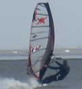
Mike thanks very much mate, good to hear some postive feedback. Monday / Tuesday not quite coming off as planned, but reading everyones' session comments, on the a whole, a pretty decent time was had by most, IanR capitalising on the two day sesh. 
and not a wiff of being skunked, with the forecast at 5 days pretty much holding all the way to the session days
I'll be back on the water soon! Proper West next time please!
| |